
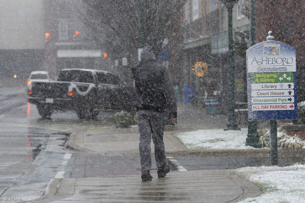
ASHEBORO N.C. (ACME NEWS) — A significant winter storm is expected to impact central and eastern North Carolina starting Wednesday, bringing a mix of snow, sleet, and freezing rain. Governor Josh Stein declared a state of emergency as emergency officials prepare for hazardous weather conditions that will affect much of the state.
The National Weather Service has issued a Winter Storm Watch or Warning for nearly every county in North Carolina, effective from 7 a.m. Wednesday through 10 a.m. Thursday, with dangerous travel conditions expected to linger into the weekend.
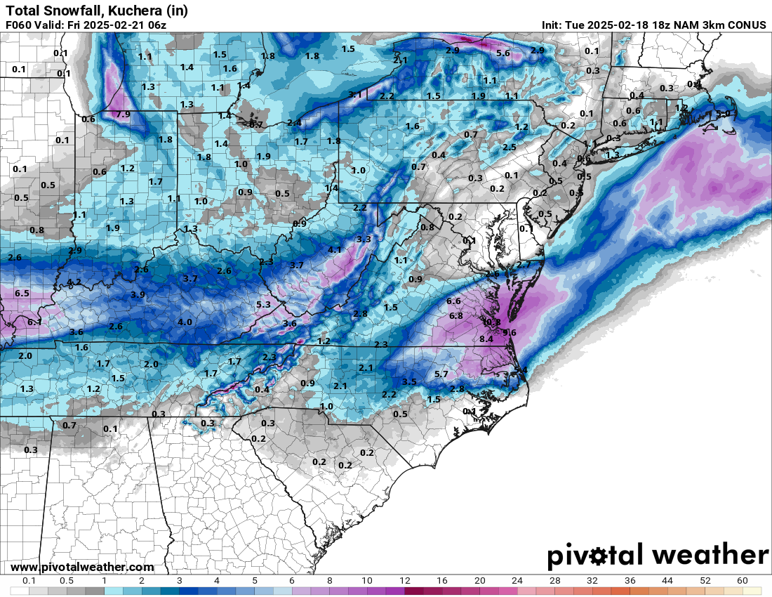
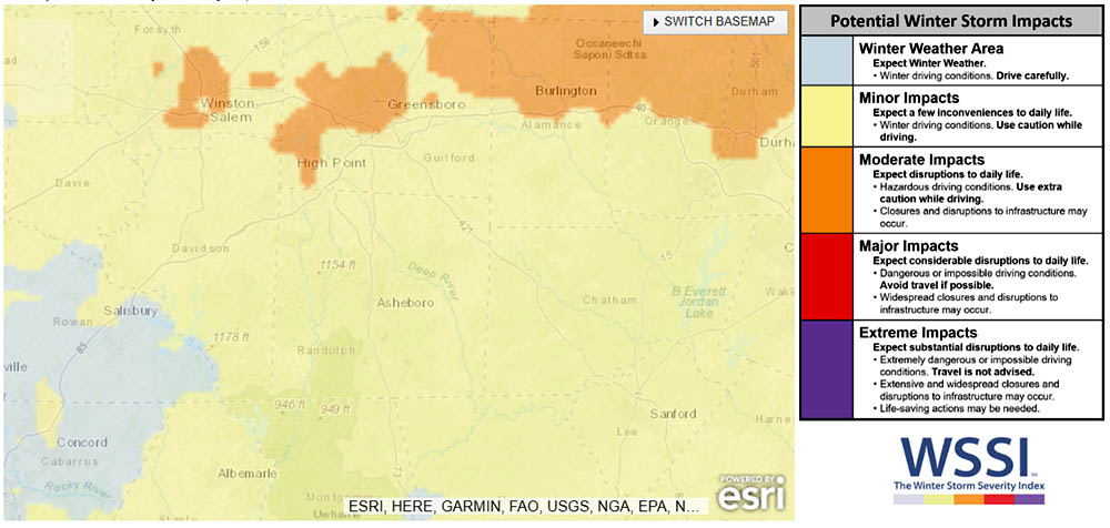
Snow and Ice Accumulations The heaviest snowfall is forecast for areas along and north of U.S. 64, particularly near the Virginia border, where totals could exceed 3 inches. Lighter snow accumulations are expected in the southeastern portions of the state, with 1 to 3 inches anticipated. Significant ice accumulation, up to a quarter-inch, is expected south and east of Greensboro and Winston-Salem.
The combination of snow and ice will make travel extremely hazardous, particularly Wednesday afternoon and evening. Governor Stein urged all residents to avoid travel once the storm hits and to monitor local weather reports.
Power Outages and Tree Damage Freezing rain and ice accumulation will also cause widespread power outages and tree damage, especially in central and eastern North Carolina. The weight of the ice on trees and power lines could result in disruptions that last through the end of the week. Residents are advised to keep devices charged and prepare for the possibility of power loss.
Timing and Impacts
- Wednesday Morning: Light precipitation will begin early, with heavier snow and ice developing by the afternoon.
- Wednesday Afternoon to Evening: The storm’s peak, with the most intense snowfall and freezing rain. Travel conditions will deteriorate rapidly.
- Thursday Morning: Lingering snowfall and ice, followed by bitter cold temperatures. Hazardous conditions may extend through the weekend.
- Friday and Saturday Mornings: Black ice concerns as refreezing overnight could make roads treacherous.
Preparations and Safety Governor Stein activated the State Emergency Response Team, working alongside the Department of Transportation, the North Carolina National Guard, and other state agencies to ensure resources are available to support local communities. The N.C. Department of Transportation has pre-treated hundreds of miles of roads and is prepared for round-the-clock snow and ice removal.
Residents should finalize their preparations today by ensuring they have extra food, water, batteries, and blankets. If travel is necessary, drivers should carry an emergency kit and be prepared for hazardous conditions.
For real-time travel updates, visit DriveNC.gov, or follow NCDOT on social media. For power outage information, visit ReadyNC.gov.
###