
ASHEBORO, N.C. (ACME NEWS) — Two small earthquakes struck northern Randolph County within half an hour of each other on Easter Sunday afternoon, slightly shaking homes across parts of Randolph and Guilford counties and drawing questions from residents.
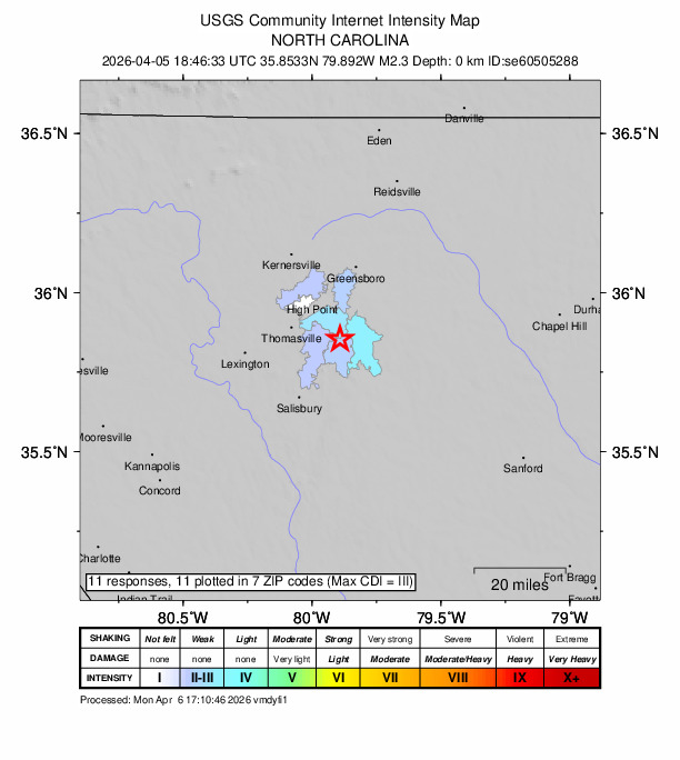
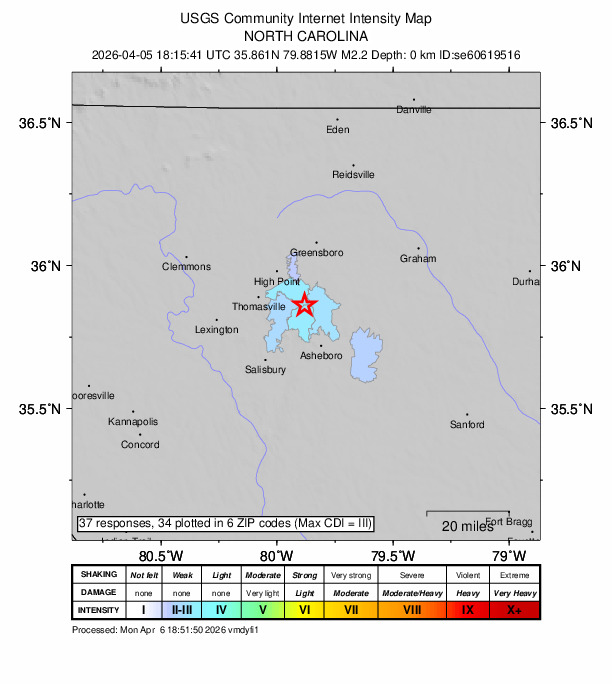
The first quake hit at 4:15 p.m., with its epicenter located near Banner Whitehead Road, just off Interstate 74 in the Glenola community. Roughly half an hour later, at 4:46 p.m., a second quake struck near Edgar Road, not far from Holly Ridge Golf Links — less than two miles from the first.
Combined, the two events drew 48 reports to the USGS “Did You Feel It?” system, spread across 13 ZIP codes in Randolph and Guilford counties. Residents also took to social media. One Randleman resident described it as “a loud boom” that rattled their house in a Facebook post.
Randolph County Emergency Services received several 9-1-1 calls about the shaking, but no injuries or structural damage were reported.
The N.C. Department of Environmental Quality confirmed that both quakes registered magnitude 2.3 and occurred at exceptionally shallow depths — roughly 0.1 to 0.2 kilometers below the surface. Officials say that proximity to the surface is why many residents nearby felt them, though at that magnitude neither quake posed any risk of damage.
The two epicenters sat about a mile apart, a pattern state geologists said is consistent with a slip along closely spaced fractures or small unmapped fault segments within the Piedmont bedrock. The activity, they added, is typical background seismicity and not a sign of anything larger developing.
“This region is underlain by ancient, highly deformed metamorphic and igneous rocks containing longstanding structural weaknesses formed during past mountainbuilding and faulting episodes,” explained the NC Geological Survey, a division of the Department of Environmental Quality, in an email. “Modern stress within the North American Plate can occasionally reactivate these older features, producing small earthquakes like those observed in Randolph County.”
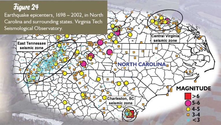
Unlike California, where earthquakes trace regularly along active fault lines, North Carolina’s known faults are ancient and inactive. Small tremors like Sunday’s tend to be scattered, random movements of the crust — the state geological survey compares them to the creaking and settling of an old house.
Seismic activity is more common in the mountains of western North Carolina, where the Eastern Tennessee Seismic Zone extends into the state. In the Piedmont and Triad, quakes are rarer. The last comparable event near the Triad was a 2.2–2.3 magnitude series in 2023 near McLeansville in Guilford County. The largest quake centered in North Carolina was a magnitude 5.5 on February 21, 1916 near Skyland, NC.
###